What is the Polar Vortex and how does it cause extreme winter cold in the United States?
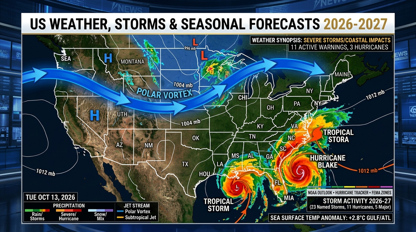
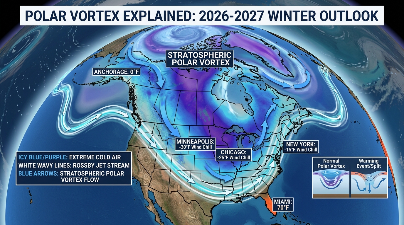
The Polar Vortex is a persistent, large-scale cyclone of frigid air circulating high in the stratosphere (10 to 30 miles above the North Pole). When strong planetary atmospheric waves disrupt or split this circulation—a phenomenon called Sudden Stratospheric Warming (SSW)—the jet stream buckles southward, unleashing sub-zero Arctic air across the Midwest, Plains, and Eastern US for 1 to 3 weeks.
Polar Vortex Wind Chill Index, Frostbite Timer & Home Pipe-Freeze Calculator
1Stratospheric vs. Tropospheric Polar Vortex: The Counterintuitive Physics
Although television broadcasts popularized the term 'Polar Vortex' during the historic January 2014 North American freeze, meteorologists have tracked the phenomenon since the 19th century. To understand how it shapes winter weather in 2026–2027, it is essential to distinguish between two stacked layers of atmospheric circulation: the stratospheric polar vortex and the tropospheric polar vortex.
The stratospheric polar vortex forms every autumn as solar radiation vanishes over the North Pole, cooling the polar stratosphere (roughly 10 to 30 miles above Earth's surface, measured at the 10-hectopascal pressure level) while mid-latitudes remain relatively warm. This steep thermal gradient generates a ferocious west-to-east ring of winds—the Polar Night Jet—often exceeding 150 mph. Counterintuitively, when the stratospheric polar vortex is at peak strength, it acts like a tight spinning top that traps bitter Arctic air over the North Pole, resulting in a positive Arctic Oscillation (+AO) and mild winter weather across the United States.
Extreme US winter freezes occur only when the polar vortex weakens, stretches, or splits into two daughter vortices. When large-scale Rossby waves generated by Eurasian snow cover, Himalayan mountain torque, and North Pacific sea surface anomalies propagate upward into the stratosphere, they break like ocean surf against the vortex wall. This wave-breaking decelerates or reverses the westerly winds—an official Sudden Stratospheric Warming (SSW) event—pushing lobes of dense, sub-zero Arctic air southward into Canada, the Midwest, Texas, and the East Coast.
- 10 hPa Zonal Wind Reversal: An official Major SSW occurs when zonal mean winds at 60°N and 10 hPa (~100,000 feet altitude) reverse from westerly to easterly.
- Stretched Vortex vs. Split Vortex: Even without a full wind reversal, a 'stretched' vortex rebounding off stratospheric ridges over Alaska often sends severe cold blasts directly into the Central and Eastern US.
- 10-to-18 Day Downward Propagation: Anomalies in the stratosphere take roughly two weeks to drip downward into the troposphere where surface weather occurs.
2NWS Wind Chill Formula, Frostbite Thresholds & Power Grid Vulnerability
When a polar vortex lobe descends across the Great Plains, Midwest, or Northeast, radiative cooling over snow-covered ground combines with tight pressure gradients between a 1045+ mb Arctic high and departing coastal lows. The National Weather Service (NWS) calculates Wind Chill Temperature using a standardized human facial heat-transfer formula adopted in 2001: Wind Chill (°F) = 35.74 + 0.6215T - 35.75(V^0.16) + 0.4275T(V^0.16), where T is air temperature in °F and V is wind speed in mph measured at 5 feet above ground.
In 2024–2027 operational alerting, the NWS consolidated legacy 'Wind Chill Watch/Warning' products into simplified, action-oriented 'Extreme Cold Watch' and 'Extreme Cold Warning' alerts. Regardless of Whether high winds accompany the Arctic air mass or calm radiational cooling prevails, temperatures dropping below regional thresholds (-20°F to -35°F in the Northern Plains/Midwest, or 0°F to 10°F along the Gulf Coast) trigger mandatory Extreme Cold Warnings.
Beyond human health hazards—where wind chills of -30°F to -45°F cause frostbite on exposed skin in 10 minutes—polar vortex outbreaks test regional electrical grids (ERCOT, PJM, MISO, ISO-NE). During the February 2021 Texas freeze and December 2022 Winter Storm Elliott, frozen natural gas wellheads, uninsulated instrumentation lines, and surging electric resistance heat demand forced emergency load shedding rules across multiple states.
32026-2027 Polar Vortex Forecast: Key Teleconnection Signals to Watch
Monitoring when a polar vortex disruption will strike during the 2026–2027 winter requires tracking three real-time atmospheric teleconnection indices published daily by NOAA CPC: the Arctic Oscillation (AO), the North Atlantic Oscillation (NAO), and the Eastern Pacific Oscillation (EPO).
When the EPO turns sharply negative (a high-latitude blocking ridge forms over Alaska and the Bering Sea), cross-polar flow forms a direct atmospheric highway from Siberia across the Northwest Territories into Montana, the Dakotas, Chicago, and southward to Texas. If the AO and NAO are simultaneously negative (high-pressure blocking over Greenland), the cold air cannot escape out to sea and remains locked over the eastern two-thirds of the United States for 14 to 21 days.
Official NWS Wind Chill Frostbite Time & Household Freeze Risk Matrix
| Wind Chill / Air Temp | Time to Frostbite | NWS Alert Tier | Plumbing & Home Impact | Vehicle & Grid Impact |
|---|---|---|---|---|
| +15°F to +32°F | > 60 Minutes (Low) | Freeze Warning (South) | Exterior hose bibs & irrigation freeze | Tire pressure drops 1 PSI per 10°F |
| 0°F to +14°F | 45–60 Minutes | Cold Weather Advisory | Uninsulated attic/crawlspace pipes at risk | Weak lead-acid car batteries lose 35% CCA |
| -15°F to -1°F | 30 Minutes | Cold Weather Advisory / Warning | Exterior wall plumbing freezes without cabinet flow | EV range drops 25%–35%; diesel fuel gelling starts |
| -30°F to -16°F | 10–15 Minutes | Extreme Cold Warning | Furnace runs near 100% duty cycle; ice dams form | Lead-acid batteries lose 60% cranking power |
| -45°F to -31°F+ | 5–10 Minutes (Critical) | Extreme Cold Warning (Life-Threatening) | Rapid interior pipe bursts if power fails > 4 hrs | Grid peak load alerts; untreated diesel gels solid |
4-Step Polar Vortex Home & Personal Protection Protocol
Monitor the 10-Day AO, EPO & Stratospheric 10 hPa Forecast
Watch NOAA CPC teleconnection charts for a simultaneous negative drop in the EPO and AO, which gives 7 to 12 days of advance warning before an Arctic outbreak reaches US borders.
Protect Exterior Wall Plumbing & Maintain Thermostat Continuity
During sub-zero nights, open kitchen and bathroom vanity cabinet doors on exterior walls to circulate warm indoor air and let faucets drip at a slow, steady pencil-lead trickle.
Winterize Vehicle Batteries, Tire Pressures & Diesel Anti-Gel
Test 12V battery Cold Cranking Amps (CCA), switch to -25°F winter windshield washer fluid, and treat diesel fuel tanks with winter anti-gel additive before temperatures drop below 15°F.
Dress in 3 Technical Layers & Eliminate Exposed Skin Outdoors
Use a moisture-wicking synthetic/merino base layer, high-loft fleece or down insulating mid-layer, and windproof outer shell with ski goggles and balaclava when wind chills fall below -15°F.
Curated Expert Video Walkthroughs & Wall Street Briefings


Frequently Asked Questions (Verified Statutory Answers)
Q1: Is the Polar Vortex a new storm system?
No. The Polar Vortex is a permanent winter atmospheric circulation high above the poles that has existed for millions of years. The phrase refers to the planetary-scale cyclonic wind belt, not a single snowstorm.
Q2: Does a strong Polar Vortex mean colder weather in the United States?
Actually, the opposite is true. A strong, stable Polar Vortex traps frigid Arctic air tightly near the North Pole, resulting in milder winter weather across the contiguous United States. Severe US cold snaps happen when the Polar Vortex weakens and wobbles southward.
Q3: What is Sudden Stratospheric Warming (SSW)?
Sudden Stratospheric Warming is an event where atmospheric waves rise into the stratosphere and cause temperatures 10 to 30 miles up to spike by up to 90°F in just a few days, reversing the polar night jet and pushing Arctic cold into mid-latitudes 10 to 18 days later.
Q4: At what wind chill temperature does frostbite happen in 10 minutes?
According to the National Weather Service Wind Chill Chart, frostbite occurs on exposed human skin in just 10 minutes when the wind chill reaches -30°F to -45°F (for example, an air temperature of -15°F with a 25 mph wind).